

Slievemore [An Sliabh Mor]
Good walks are even better shared.
F6508 : Slievemore summit with view towards Croaghaun, Achill Island
Colin Park Photo source
Overview
Slievemore, An Sliabh Mór, is a 669 m mountain on Achill Island in County Mayo. The west-ridge walk from the Deserted Village reaches a trig-point summit above Atlantic coastal scenery. The island's Slievemore is distinct from other Irish hills with the same name.
Slievemore, Achill [An Sliabh Mór]
Slievemore, An Sliabh Mór, is a 669 m mountain on Achill Island in County Mayo. The west-ridge walk from the Deserted Village reaches a trig-point summit above Atlantic coastal scenery. The island's Slievemore is distinct from other Irish hills with the same name.
Summit and geology
The recorded summit feature is a trig point. The west-ridge guide also describes a shelter cairn a little beyond it; the cairn is not a substitute for the recorded summit location.
Geological Survey Ireland describes Dalradian metamorphic bedrock on Achill's north coast and identifies the Slievemore Psammitic Formation. The National Parks and Wildlife Service describes pre-Cambrian schists and gneisses at Slievemore. These broad-area accounts do not establish the exact summit rock contact; a granite-and-limestone description is unsupported.
Walking routes
Deserted Village and west ridge, same-way return
Start at the parking by the graveyard below the Deserted Village. Follow the village track before leaving it to climb pathless ground onto the broad west ridge. Continue past the rock band and small lochan, then negotiate the steeper and boggier upper ground to the summit trig point. Return by retracing the same west-ridge line, rock-band passage and village track to the original graveyard parking. Get Lost Mountaineering records 8 km and about 4 hours for this complete return, from an outing on 5 September 2018; no total ascent is supplied. Current local access and parking must be checked. https://getlostmountaineering.co.uk/walks.php?id=1022
Terrain, views and safety
The west-ridge outing starts on a track through the Deserted Village, then crosses pathless grassy ground, a rock band, steeper slopes and boggy upper terrain with outcrops.
The route guide describes wide seascape views in clear weather, with some higher mainland peaks visible when conditions are particularly clear. Visibility is weather-dependent.
Pathless ground and broad upper slopes require mountain navigation, especially in Atlantic mist. The west-ridge route crosses a rock band, boggy ground and steeper sections; retrace the line you can safely negotiate. Check weather and daylight, carry warm and waterproof layers, food, water and navigation equipment, and turn back if conditions exceed your ability. For a mountain emergency call 999 or 112, ask for Gardaí/Police, then Mountain Rescue. Mobile coverage is not assured.
These are source-based route outlines, not turn-by-turn navigation or a current access or conditions check. Carry appropriate mapping and navigation equipment.
Access and facilities
The 2018 west-ridge account starts at parking by the graveyard below the Deserted Village, approached from Keel. Check current local permission and notices, and keep the graveyard entrance and funeral access clear. Present capacity, fees and availability have not been verified.
Bring food and water for the mountain outing. Current toilets, refreshments and business opening hours at the start have not been verified. Access can depend on landowner goodwill, so check local circumstances and follow notices; general commonage descriptions do not establish unrestricted public access.
A current trailhead public-transport service and last return have not been verified; check before travelling.
Name and history
Paul Tempan gives An Sliabh Mór, meaning the big mountain, for the Achill and County Mayo entry at F650086.
Achill Archaeological Field School records dry-stone byre-house remains at the Deserted Village and 137 houses on the 1838 Ordnance Survey map. Separate excavations above the village identified Bronze Age roundhouses. These lower-slope remains are not summit archaeology, and the evidence does not justify a single-cause story of abandonment.
Explore routes near Slievemore [An Sliabh Mor]
Walks starting near this hill. Open a route to check its map, distance and full itinerary.
Route planning notes
These notes describe possible approaches. Check a route's map and access information when planning your walk.
Deserted Village and west ridge, same-way return
Start at the parking by the graveyard below the Deserted Village. Follow the village track before leaving it to climb pathless ground onto the broad west ridge. Continue past the rock band and small lochan, then negotiate the steeper and boggier upper ground to the summit trig point. Return by retracing the same west-ridge line, rock-band passage and village track to the original graveyard parking. Get Lost Mountaineering records 8 km and about 4 hours for this complete return, from an outing on 5 September 2018; no total ascent is supplied. Current local access and parking must be checked. https://getlostmountaineering.co.uk/walks.php?id=1022
Make a day of it, together
Find someone to share the walk with, or organise a day out along a route you like.
Photo Gallery
View all Photo could not load
F6508 : Slievemore summit with view towards Croaghaun, Achill Island
Colin Park
Hill facts and local notes
Classifications
Elevation
669m
2,195 ft
Prominence
581m
Coordinates
54.0097, -10.0595
F650086
OS Map
22 30
At the Summit
The recorded summit feature is a trig point. The west-ridge guide also describes a shelter cairn a little beyond it; the cairn is not a substitute for the recorded summit location.
Terrain & Geology
Geological Survey Ireland describes Dalradian metamorphic bedrock on Achill's north coast and identifies the Slievemore Psammitic Formation. The National Parks and Wildlife Service describes pre-Cambrian schists and gneisses at Slievemore. These broad-area accounts do not establish the exact summit rock contact; a granite-and-limestone description is unsupported.
Views & Scenery
The route guide describes wide seascape views in clear weather, with some higher mainland peaks visible when conditions are particularly clear. Visibility is weather-dependent.
History & Heritage
Name Origin
Paul Tempan gives An Sliabh Mór, meaning the big mountain, for the Achill and County Mayo entry at F650086.
Historical Significance
Achill Archaeological Field School records dry-stone byre-house remains at the Deserted Village and 137 houses on the 1838 Ordnance Survey map. Separate excavations above the village identified Bronze Age roundhouses. These lower-slope remains are not summit archaeology, and the evidence does not justify a single-cause story of abandonment.
Getting There & Facilities
Parking
The 2018 west-ridge account starts at parking by the graveyard below the Deserted Village, approached from Keel. Check current local permission and notices, and keep the graveyard entrance and funeral access clear. Present capacity, fees and availability have not been verified.
Nearby Facilities
Bring food and water for the mountain outing. Current toilets, refreshments and business opening hours at the start have not been verified. Access can depend on landowner goodwill, so check local circumstances and follow notices; general commonage descriptions do not establish unrestricted public access.
Safety Information
Known Hazards
- Pathless ground and broad upper slopes require mountain navigation, especially in Atlantic mist.
- The west-ridge route crosses a rock band, boggy ground and steeper sections; retrace the line you can safely negotiate.
- Check weather and daylight, carry warm and waterproof layers, food, water and navigation equipment, and turn back if conditions exceed your ability.
- For a mountain emergency call 999 or 112, ask for Gardaí/Police, then Mountain Rescue. Mobile coverage is not assured.
General Safety Tips
- Check weather conditions before setting out
- Carry appropriate clothing and equipment
- Let someone know your planned route
- Take a map, compass, and GPS device
- Carry emergency supplies: food, water, first aid kit, torch
Hills
Some common questions about the hills answered
Are there group walks up Slievemore [An Sliabh Mor]?
Many walkers use Walkmates to join or organise walks with others. You can check for group walks around Slievemore [An Sliabh Mor] through the maps
Are there other walkers around Slievemore [An Sliabh Mor]?
Activity varies by location and time, but Walkmates lets you see whether others have shared walks or shown interest in this area. Find other people through the walking friends search walking friends for Slievemore [An Sliabh Mor] search or of course create your own walk for Slievemore [An Sliabh Mor]
Can I organise a walk to Slievemore [An Sliabh Mor]?
Yes. If there aren’t any walks listed already, you can create a walk and make it available for others to join.
If you're signed up to Walkmates, you can create a walk to Slievemore [An Sliabh Mor].
How do I find a walk up this hill?
There are often multiple ways to walk this hill, depending on experience and route preference. Walkmates helps you explore walks and routes that others have shared.
Can I suggest a new route up Slievemore [An Sliabh Mor]?
Yes. You can suggest or create routes to share with others. Walkmates focuses on the social side of walking, so routes are used to help people organise walks and explore areas together, rather than as detailed navigation tools or route libraries.
Other uses really appreciate knowledgeable walkers sharing their routes. Share your favourite route to Slievemore [An Sliabh Mor] here
The is an error or something incorrect about this hill. How do I let you know?
We always strive to keep the information on Walkmates as accurate as possible. If you find an error, please let us know through the contact form and we'll aim to correct it as quickly as possible
Community Discussion
Comments
Location
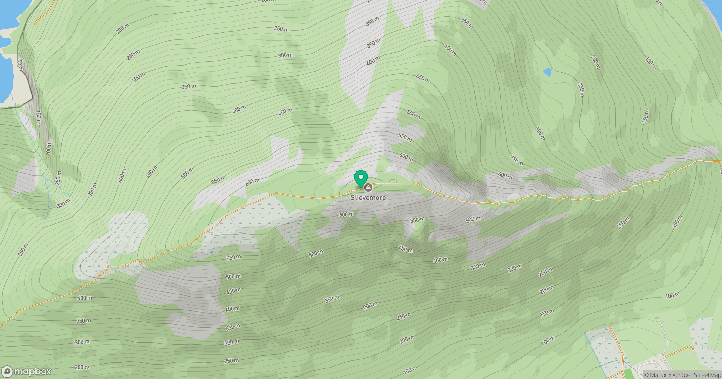
Grid reference: F650086
View on OpenStreetMapOpens a map in a new tab, centred on the hill.
No comments yet. Be the first.